


no, rather while i'm looking for these quarrys, i'm just as likely to find totally brand new fossils. which could be totally awesome, and lead to some major fame in the world of palaeontology....
it's just when you're finding fossils there are some key things to keep in mind...
_
 the most important rule of fossil hunting is location, location, LOCATION.
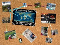
as you'll remember the point of darren's lost quarry project is to retrieve the locational info for otherwise well known and understood dinosaurs. now i already discussed why this is important in my last post about the lost quarrys, but right now i'm going to look at the overall science of stratigraphy.
stratigraphy is a fancy way for saying the science layers. the reason scientists make up more complicated words like this is so that they don't have to say long sentences like that every time their talking to each other. plus they'd sound funny if called themselves things like layertoligists! as you can see the alberta badlands offer us a great view of sedimentary rock, without any vegetation or top soil blocking our view.
rather these layers are nothing more than different piles of soil, dust, and dirt that were moved here a long time ago (in this case millions of years ago) and dumped here. after one pile (aka layer) was finished being laid down, some new force started bringing in the materials of the next pile that was laid down. with this ongoing process of pile being made on top of pile, over a long time you end up with nice sedimentary layers like these.
_
sedimentary rock is really the only one out of the three basic rock types that contain and preserve fossils properly. the other two being igneous and metamorphic, are volcanically formed. all that heat and pressure from being volcanic destroys fossils pretty good (only in some BARELY metamorphosed rocks can you sometimes get fossils remains, but their typically very damaged!). so that of course tells you that to find fossils look in sedimentary rock, but there is so much more you can get out of sedimentary rock...
a neat thing about when you find sedimentary rock, is instantly you know you have found somewhere that was once a lower area in the time the layers were being laid down. how do i know that... why it is sedimentary, my dear watson! (get it!)
in order for the layers to be made they need soil, dust, and dirt to be brought in from somewhere, and these mini rocks aren't going to move on their own. they need gravity to move them (whether it be them tumbling along on their own or being moved by water flowing downstream), and thus they came from a higher spot to this lower one.
the only unfortunate thing about this is, in the case of fossils defiantely, you rarely get glimpses of the high places, as no layers or fossils get laid down there...
_
 because each layer was laid down in a different fashion than the layer above and below it, it has a different story to tell (even if there are no fossils... these rock only stories can be very important to other layers with fossils!). each of these marked spots on the photo are like a chapter in this hill's prehistoric record book (some layers have so much going on they could be a whole story on their own, that alone a chapter in a story!).
these layers tell us their stories in a few key ways.
each layer was laid down at a specific time that is different from the others. meaning anything you find in that layer is a record of that exact period of time, whenever that may have been.
some sedimentary layers can be laid down in very fast events like a flood or sandstorm in a matter of days or even hours!... others though can be super slow like the build up at the bottom of a lake or in the middle of a plain over thousands of years. meaning just the amount of time captured in that layer tells a story... but the layers put together tell an even bigger story.
_
a constant rule in geology is the law of superposition, which states that the further up the pile of layers you go from the bottom, the you are the closer you get to the present. which makes sense when you think about it. the older layers have to be in place before any newer layer can be put on top of it!
now there are geologic events hat can happen after layers are all in place that can mess up this order. sometimes it'll make them all suddenly sideways, or sometimes pushed slightly out of order, but as these usually have to do with mountains or earthquakes i won't worry about them today. i'm in the badlands, and here the layers are nice and undisturbed! (other than a very minor tilt you'll see later on)
the very mechanism that laid down any layer is important too. especially to us fossil hunters!
_
 sure this hill in front of me looks like a jumble of randomly coloured and textured rocks, but standing here i can tell you a lot about the changes that happened in this spot 70 million years ago. remember i'm no genius either! i simply know the different types of sedimentary rock and what they represent.
sure you need a professional geologist to tell the detailed story, mine will seem pretty simple in comparison. yet what i can tell you is still neat.
in this hill something like this went down in this very spot! a river once flowed during the bottom layer, and than it was replaced with a lake, that later turned into a swamp, till another river washed that away again, with many more layers and events above that. it may lack specific details, but it works great for fossil hunting! (its once you've found the fossil and worrying about it scientifically you need to find out more details...)
if you can figure out what sort of prehistoric environment(s) are recorded in the hill than you can guess what types of fossils are to be found in them. so if you are looking for specific fossil types, you need to tailor your searching to rock deposits that are more likely to have what you are looking for.
now as i'm looking for a francis slate dig site that had dinosaurs in it, i need to find rocks that were laid down in a dinosaur's environment. which means i need land based deposits, not oceanic. which may sound silly to worry about in the middle of canada, but back in the cretaceous there was an ocean within at most a few kilometers from where i stand now! every now and then this ocean would occasionally flood over this area. meaning i could find rocks from either land or marine (a different word for saying oceanic) environments.
_
so as i head out looking for quarrys and fossils in the coming weeks here are the types of rock i'll be seeing, and what they might mean...
_
 well the name says it all, sandstone is a "stone" made of sand. all sandstone is, is sand that has been tightly squished together by the pressure of being buried under all the other rock layers above it.
_
i like to think of it as the rock version of sandpaper. it has the same texture and look, and it is even rough like sandpaper! only unlike sandpaper, sandstone comes apart. the reason is again this is tightly bunched bunch of sand. that's it. just sand! there is nothing actually holding it together once it is exposed out in the open (compared to buried deep in the ground that pushes them together).
_
simply touching it, getting it wet, or even just having the wind blow over it slowly erodes sandstone back down into ordinary sand. which will once again be carried away, and possibly go onto form a new sandstone layer somewhere else!
_ so what story does sandstone tell. well sand is of course small particles, but as far as sedimentary rock building blocks are concerned sand is pretty big. after all you can make out a sand spec with your bare eye. some of the other sedimentary elements are so small i couldn't tell you what they look like, and without a microscope you couldn't check even if i did.
not our friend sand. it's pretty big. so because of this something stronger had to move it here. in most cases this is fast moving water (though in a desert fast wind can do the trick, but as alberta wasn't a desert in the cretaceous it must have been water). that could mean two things. either the ocean which is the most very powerful and fast moving water system on earth, or it could have been a river.
for dinosaur fossils i want a river, but not being a geologist i couldn't tell you which sandstone is river based or marine. i'll need to look at the other layers around it to get my clues...
 another well named "rock". this is simply mud that has either dried out and/or been buried and turned to stone. unlike sandstone it doesn't have a clear building block to look for. mud is made of those smaller particles i was talking about earlier taht are too small to make out with the naked eye (though how you dress your eye is another problem i don't want to worry about right now!). instead of a sandy grained layer surface you'll get a smoother one like this, or the popcorny texture one in the picture below.
mudstone being made of these smaller bits shows you that it was slow moving water (as mud has to be wet after all!). the reason you can tell this wasn't fast water was it would wash these small light particles away before they could form a layer, unlike bigger heavier sand which it couldn't wash away as easy (and again why you can tell sandstone is fast water!).
water only moves slowly on land. in the ocean water is always moving, and with force. on flat bits of land water can not just slow down, but come to a near stand still (compared to the ocean anyway). meaning mudstones only form in lakes, swamps, or extremely slow rivers. meaning if you have mudstone you are looking at somewhere that was on the land!
 why does mudstone form this crazy popcorn texture though you're asking? after all mud doesn't look anything like this. if you find a layer like this, whether it has fossils or NOT, it is a great find!
a neat thing about mudstone is that because it was made of such fine silty material it used to catch all sorts of particles when it was mud. this makes sense, as if you think about it, mud can be very sticky when you step in it (thus why you can get some great fossils stuck in it too!). as there was a lot of volcanoes going off in british columbia during the late cretaceous, there was a lot of volcanic ash and soot floating around in the air. some of it made it into alberta, and some of this ended up getting stuck in the mud around here.
it is these bits of volcanic ash, called bentonite, that cause this popcorning effect in the mudstone. bentonite is like a very tiny rock version of a sponge, and not only does it soaks up water like a sponge. it swells up as it does so. meaning if i took this photo while it was raining, all the cracks between the "popcorn" would be gone, as all the bentonite would have expanded to fill in the gaps. it's only when the mudstone dries out and shrinks that these mini fissures appear in the hillsides.
there is a good reason i didn't take this picture when it was raining though. because the bentonite expands when it is full of water, it gets really squishy on the microscopic level (picture squishing a soaked sponge, it is squishy too). when you step down on it, your weight pushes the water out of the bentonite and causes it to shift. not that you can see this (again we're talking microscope tiny), but what you do notice is how slippery bentonite is when it shifts under you. it is seriously like stepping on a banana peel in a cartoon! so a good safety tip is not to go fossil hunting in the rain or just after it has...
why is finding a bentonite layer good than? well the cool things about volcanic rocks is you can use them to find out the age of the layer. in a normal layer of mudstone (as in not popcorny) or sandstone there is no way to accurate figure out how old it is. however as bentonite is ever so slightly radioactive it is possible to find out its rough date or origin. meaning if you find more than one bentonite layers in an era you can figure out roughly when the layers in between these mudstone layers occurred (though not preciously).
 these layers are of course what brought people to the alberta badlands in the first place, as in the olden days coal was the main form of fuel. nowadays it is handy for a fossil hunter, but not great. when i go looking i only want to see one coal seam. more than that can be bad news for finding fossils, though not always...
coal seams are the direct fossil remains (why we call it a fossil fuel) of a former swamp. the coal is all the dead rotting vegetation that would have built up at the bottom of the swamp as the generations of plants grew on top of the last only to die themselves and themselves be grown on top of... after being buried underground, all the pressure and compression from the rocks above would crush this vegetable matter into its dense burnable form.
so the fact that coal is a sort of fossils itself sounds like it should be great for finding dinosaurs and other fossils right? i hear you say, traumador it sounds even better than that, as a swamp would have had lots of plants for animals to eat and thus attract them. we should find tons of dinsoaurs there right?... sadly wrong...
the problem is what the coal was before it turned into coal. rotting plants in the concentration they are in a swamp produce a ton of acid. acid eats away at everything organic, even hard parts like bones and shells... so coal is terrible for finding fossils in as it would have dissolved them long before being buried.
mind you it is not impossible. one of the royal tyrrell's new ceratopsians, eotriceratops, was miraculously found in a coal seam! though their still studying how it stayed preserved, i'd venture it was because ceratopsian skulls are big and tough... though it was still fairly damaged, and this was a fluke find frankly.
coal generally is not good for looking for fossils. however a coal seam or two is a good clue that your other layers above and below it are from land based environments. after all, have you ever heard of a swamp in the middle of the ocean!
 this is the last type of rock around drumheller i'm going to bump into. however ironstone is a fossil hunters nightmare no matter how you break it down (if you can break it down! its tough as, yo!!!)
ironstone IS a type of sedimentary rock, BUT unlike the other layers i just discussed it was not deposited in a proper layer like the others, nor was all of it formed in the cretaceous during the time of the dinosaurs (though as you'll see we're not sure when all of it formed). for you see ironstone is an intruder rock.
ironstone is just a giant ball of concentrated rust. seriously. it was once nice shiny iron, but than it was rusted away by water. this water than carried that rust into the ground as it seeped through the itsy bitsy cracks inbetween the rocks of the badlands. whenever the water passed through something too tight for the rust, well the rust was left behind, and as more water came through more rust it was left to build up around the rust that came before it. so after a while you'd get big nodules of the stuff. a nodule is just a geologist word for bunch or cluster of something.
one of the things that can block the flow of the rust through the layer were fossils... meaning you can get a dinosaur bone or petrified wood totally encased in ironstone (there is a few bits of wood in the ironstone pictured above). which is terrible on all fronts! you can't see the fossil, and even if you do, ironstone is still a kind of metal so, it is really hard to get off the fossil!
ironstone also tends to form above sandstone. the bigger tightly packed bits of sand don't allow the rust to follow the water through it. this has lead to some trouble figuring out when the ironstone formed. there are many geologist who think this is evidence that the iron was dissolved during the time of the dinosaurs as otherwise how would the rust make it to lower down sandstone layers. other geologists argue the ironstone was laid down well after the cretaceous, and the different layers of ironstone represent different qualities of both the rust AND sandstone. there are a few who think it is a mix of the two, and that some ironstone is cretaceous aged, and some of it is more recent.
answering this isn't easy. ironstone isn't volcanic and so it can't be dated.
i'm a little interested as to what the answer is, but at the same time i hate ironstone. so i'm not losing sleep over it!
anyways that does it for the sedimentary rocks around the albertan badlands. there are other types elsewhere in the world, but i won't worry about them today, as i'm not going to see them here.
 so now time for a quiz people of the webwide world!
what is the general story of this hillside from the bottom up?
 once geologists get a grip on an area's layers and the story they tell us we can begin to understand the setting that any fossils we find was living (or at least died) in. the amazing thing about alberta unlike most places elsewhere in the world is that we have a HUGE sequence of layers that are nearly uninterrupted for 15 million years. that is extraordinarily uncommon on its own, but for all of these chunks to bear fossils (granted some more so than others) just makes it all the more rare.
now that can be a lot of layers to sort out, and keep track of.
to help simplify geologists and palaeontologists look at a number of things to try and figure out "chapters" in the layers that help them not only figure out what they are looking at, but more important still talk about them with everyone.
these "chapters" in the rock are called formations, and they represent a series of layers that all were laid down in a set period of time (usually determined by radiometric dating), contain the same types of fossils (the back up if you can't radiometrically date an area), and/or represent the same general environmental setting.
now i've provided diagram (made by the nice guys at prehistoric insanity) that shows not only all of alberta's key cretaceous geologic formations, but what major spots in the province line up with them. it has a lot of detail, and if clicking on the picture here on my blog doesn't give you a blown up version here is a link to it on a different site.
as you can see right away due to the slight shift to the whole province caused by the long ago up thrust caused by the formation of the rocky mountains, all the layers are slightly tilted (they go downward towards the west). additionally in the picture you might notice that all the places are shown in holes. these are valleys that cut into the layers allowing us to see them, as normally they are buried under the ground.
okay technically all these towns are in the SAME really long valley that runs through all the formations, but for pointing out where these towns and places are in the geology, i thought it'd be easier to show them in seperate holes (to see exactly which exact layers are exposed around them).
 as i'm stuck in drumheller, i'm going to be searching for things in the horseshoe canyon and the bearpaw foramtions. the horseshoe is named after the famous horseshoe canyon just outside drumheller, and represents a really flat flood plain (aka on land). the bearpaw is named for the bearpaw sea, which was an inland ocean (meaning an ocean back then where there is land today) that covered the middle of all north america and split it into 3 subcontinents, and was just off the shore underwater...

so out of these two formations, i want to stick to the horseshoe formation as its the only one with dinosaurs. lucky for me these are the rocks directly surrounding drumheller and the museum. the bearpaw layers are about 10-15 minutes drive out of town towards east coulee. so i won't be heading out there just at moment...


3 comments:
Nice Geology lesson. Speaking of Sedimentary rock, here in Kentucky, we are loaded with Limestone. This contributes to the whole "Bluegrass" thing. Granted I'm not a native to Kentucky, I DO know some of the Geology of Kentucky. (Hey, that gives me a great idea for a post!!)
really nice lesson! I always hear the word "Formation" but this is the first time I read an explanation for that word. I had figured out the concept somehow but I hadn't ever read an explanation .... at least before reading this post.
I really don't know if we ahve that iron rocks but I always hear that rocks from the Amazon are really difficult to study. We have a theropod that nobody has been able to remove from its stonegrave just because the rock is too much for the people that has ever tried to work on it.
Thank you for your blog post I have been searching for a geological explaination for all the different layers of sand and rock in the badlands of Alberta. When out with my family we also found what look like quartz crystals in amongst the coal layer. Just wondering if they were quartz or something else. Some of them are rather brittle, others strong. I like to be able to tell the kids about natural history of the areas we go.
Post a Comment